 Straddling the border of Utah and Colorado, Dinosaur National Monument (DNM) is one of the richest exposures of dinosaur fossils in the world.1 But not just dinosaurs are on display. DNM also contains equally breathtaking rock exposures and sheer canyons.
Visitors usually begin at the Quarry Visitor Center, located about 20 miles east of Vernal, Utah. Shuttle buses take them about a half mile to the Quarry Exhibit Hall where the dinosaur fossils are exposed in a steeply dipping wall of rock. About 30 miles east of this is the Canyon Visitor Center near Dinosaur, Colorado, which is the gateway to DNM’s canyonlands. Overlooks along Harpers Corner Road allow visitors to view the canyon walls that rise several thousand feet above the Green and Yampa Rivers.
The story of DNM began on August 17, 1909, when Earl Douglass of the Carnegie Museum found eight vertebrae of an Apatosaurus. This discovery led to the opening of the famous Dinosaur Quarry.2 In 1915, President Woodrow Wilson designated the 80 acres surrounding the quarry as a national monument. Since then, Presidents Franklin Roosevelt and Gerald Ford, with the help of the U.S. Congress, expanded the protected area to over 328 square miles (210,280 acres).2
Today, the fully enclosed Quarry Exhibit Hall allows visitors to view over 1,500 fossils still in place in an exposed sandstone wall of the Morrison Formation. Amazingly, many of the dinosaur fossils are either partially articulated (still together) or nearly complete.

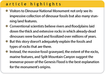
Because DNM is located on the eastern end of the Uinta Mountains, its eroded canyons expose many varieties of rocks.1 Totaling about 8,000 feet in thickness, these colorful, fossil-rich sedimentary rocks include five of the six megasequences (all but the Tippecanoe). And below this stack of rocks are thick layers of pre-Sauk (Precambrian) sediments of the Uinta Mountain Group, totaling over 6,900 feet in thickness.3 But how did this thick stack of sediments get here? And how did so many dinosaurs get buried in such a small area?
The Conventional Account
The conventional explanation is that these rocks began accumulating hundreds of millions of years ago and built up slowly over vast eons. Evolutionary paleontologists believe the layer that contains the dinosaurs, the Morrison Formation, was deposited about 150 million years ago by a series of rivers and floodplains.4
Furthermore, conventional scientists postulate that hundreds of dinosaurs died in a drought, leaving their bones along a dry riverbed.4 Later, rain-swollen rivers transported thousands of bones of at least 10 different dinosaur species into the deposit at Dinosaur Quarry.4
But there are some issues with this. The fossils and types of rocks in the Morrison Formation don’t match the conventional story. Instead, three features observed at DNM point to an origin from the global Flood.
1. The Extent of the Morrison Formation
Although the Morrison Formation is only about 300 feet thick, it has a vast areal extent. It is very consistent in its layering, sediment content, and color patterns, making it distinguishable across 600,000 square miles in the American West, from Canada to New Mexico. What rivers today deposit the exact same order of sand and clay beds uniformly across such a widespread expanse? Rivers carve sinuous, narrow channels within mud-dominated floodplains, not continuous sand and clay beds that correlate across 11 states.
The global Flood is a better explanation for this vast deposit and for the burial of the dinosaurs, too. Massive waves could easily deposit the same layers in the same order as wave after wave inundated the landscape. The dinosaurs were caught in one flow, similar to a logjam. The bed formed when the flow slowed and dropped its load of sediments and carcasses.
2. A Marine Influence
The Morrison Formation reveals recognizable evidence of marine (ocean) influence.5,6 For example, there are several rippled limestone layers up to 60 feet thick.5 Limestone usually forms in a marine environment. And ripples indicate persistent currents were active during the deposition of these layers. Recent flume studies have shown that thin-layered, lime-rich mud beds form by water flowing between 10 and 20 inches per second, creating ripples and thin-layered limestone beds similar to those observed at DNM.7
In addition, many distinctively marine seashells are found in the formation near DNM, including glauconite-rich sand beds.5 The mineral glauconite is commonly accepted as an indicator of marine influence.
There is also a persistent chert layer in the Morrison. This single bed is about 0.5 to 3 inches thick and is referred to as the welded chert.5,8 Chert, or flint, is a microcrystalline variety of quartz that is marine in origin. But what’s startling is the remarkably persistent nature of this one thin layer.8 This same thin chert bed has been found across Colorado, Kansas, Nebraska, New Mexico, South Dakota, Utah, and Wyoming.8
How can a single, few-inch-thick layer extend across so many states? Again, the global Flood provides the most reasonable answer. One massive tsunami-like wave with the right chemistry could spread a thin layer of chert across this vast region. Only ocean water transported by huge waves traveling across the continent can adequately explain the land and marine mixing that is observed in the Morrison. No conventional explanation has been satisfactory.
3. River Through Split Mountain
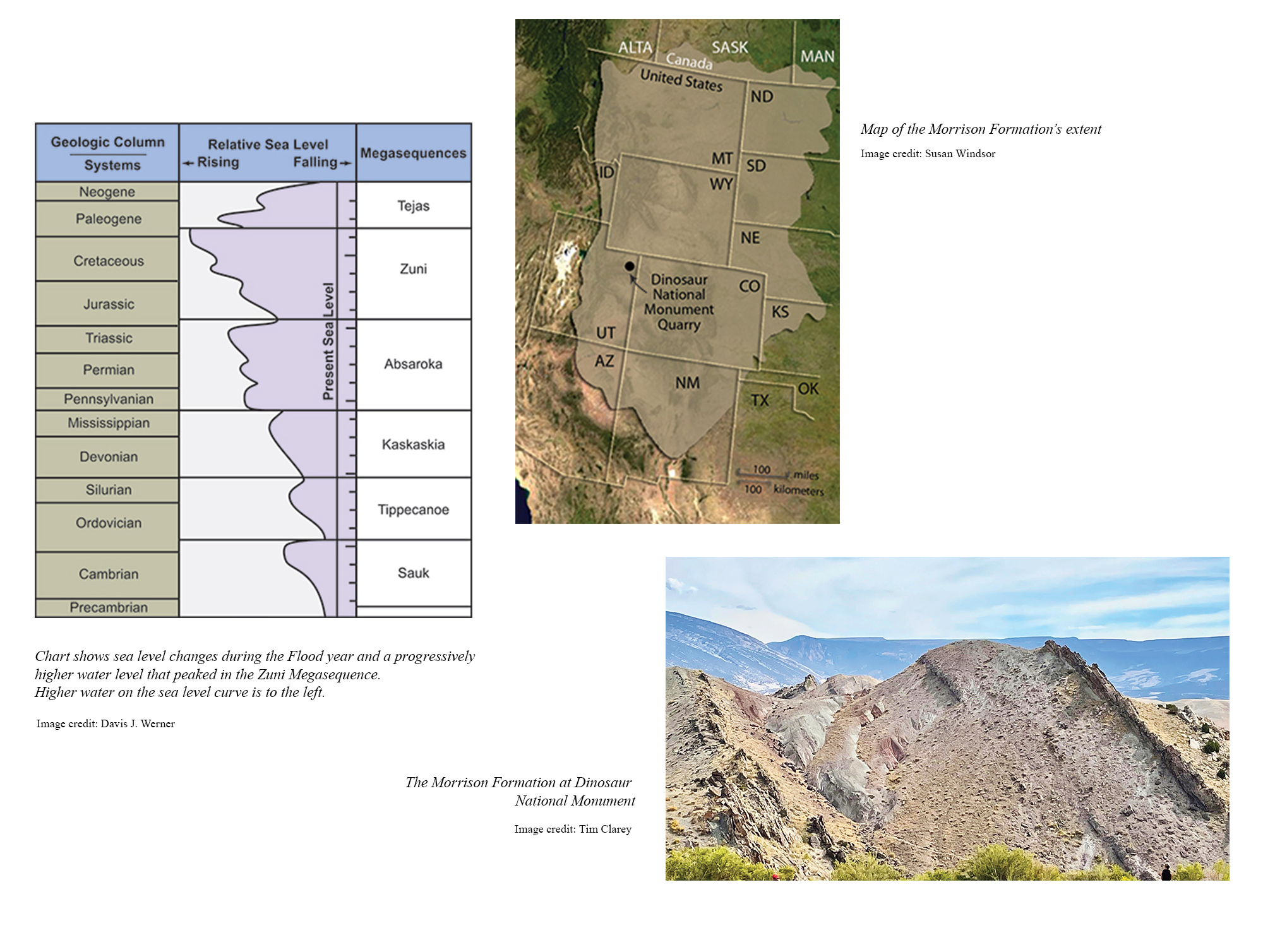
Just north of the Quarry Visitor Center, Split Mountain is over 7,600 feet high. Oddly, the Green River cuts diagonally through it to form Split Mountain Canyon, which has walls of rock that rise over 2,500 feet from the river level. Why does the river run through the large uplifted block of rock instead of flowing around it?
Some conventional scientists think these water gaps were carved by stream piracy, a unique process involving headward erosion.9 This is very tricky because it requires two streams flowing in opposite directions to meet at the exact same point and then somehow erode away enough for one stream to take over the other—hence the piracy. But this explanation doesn’t solve the problem. Even if the headwaters did touch at some time in the past, there is still a major drainage divide between the two rivers. Water would still flow away from the divide in opposite directions like it does all along the Continental Divide today.
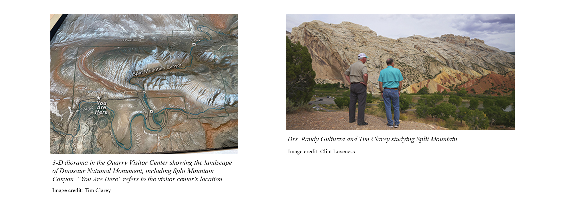
A better explanation is that water once covered Split Mountain as the Flood reached its maximum height. Later, during the receding phase, sediments composing Split Mountain were folded upward into a cylinder shape.10 As the fold rose, vertical cracks formed, cutting across the folded layers. Water draining off North America at the end of the Flood ripped into the cracks, eroding and deepening the canyon through Split Mountain. The rather small Green River resides in this canyon today.
Conclusion
The features we observe at Dinosaur National Monument are reminders of the immense power of the Flood in depositing vast layers early in the process, then eroding great quantities in the later phase. The mass collection of dinosaur bones and many other fossils, the extent of the Morrison Formation and its marine influence, and the deep canyon through Split Mountain are best explained by the global Flood.
References
- NPS Geodiversity Atlas—Dinosaur National Monument, Colorado and Utah. National Park Service. Posted on nps. gov.
- Dinosaur National Monument Park Statistics. National Park Service. Posted on nps.gov.
- Stratigraphy of Dinosaur National Monument. National Park Service. Posted on nps.gov.
- Morrison Formation. National Park Service. Posted on nps. gov.
- Sprinkel, D. A. et al. 2019. Stratigraphic Setting of Fossil Log Sites in the Morrison Formation (Upper Jurassic) Near Dinosaur National Monument, Uintah County, Utah, USA. Geology of the Intermountain West. 6: 61–76.
- Hoesch, W. A. and S. A. Austin. 2004. Dinosaur National Monument: Jurassic Park or Jurassic Jumble. Acts & Facts. 33 (4).
- Schieber, J. et al. 2013. Experimental Deposition of Carbonate Mud from Moving Suspensions: Importance of Flocculation and Implications for Modern and Ancient Carbonate Deposition. Journal of Sedimentary Research. 83 (11): 1025–1031.
- King, R. J and D. F. Merriam. 1969. Origin of the “Welded Chert,” Morrison Formation (Jurassic), Colorado. Geological Society of America Bulletin. 80 (6): 1141–1148.
- Helble, T. and C. Hill. 2016. Carving of the Grand Canyon: A Lot of Time and a Little Water, a Lot of Water and a Little Time (or Something Else?). In The Grand Canyon, Monument to an Ancient Earth: Can Noah’s Flood Explain the Grand Canyon? C. Hill et al., eds. Grand Rapids, MI: Kregel Publications, 163–171.
- Clarey, T. 2020. Carved in Stone: Geological Evidence of the Worldwide Flood. Dallas, TX: Institute for Creation Research.
Dr. Clarey is the director of research at the Institute for Creation Research and earned his Ph.D. in geology from Western Michigan University.