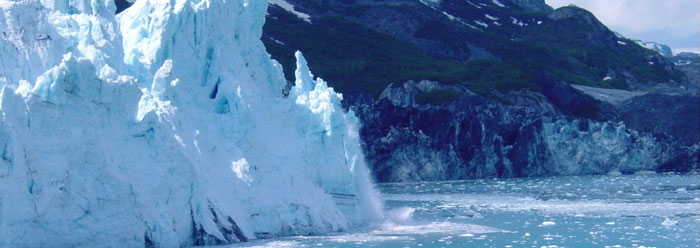
Ask anybody who has experienced spring "break-up" along the banks of an Alaskan river, and you will quickly learn that large amounts of ice seldom melt placidly. Consider an ice cap several thousand feet thick that once occupied much of the northern part of our continent. What was it like when this ice melted? The role of flooding in the post-Flood world is one of the most understated areas of geological catastrophism. Obviously, the earth has not behaved itself in a uniformitarian way. Consider a few examples.
Impounded behind a lobe of the Cordilleran Ice Sheet at the close of the Ice Age, Glacial Lake Missoula in Montana was perched at 4,200 feet above sea level. Only Washington state stood between it and the Pacific Ocean. When this ice dam failed, waters of hundreds of meters depth swept across an area twice the size of New Jersey at freeway speeds. It scoured the basaltic bedrock carving giant channels that are now dry (called coulees), deposited gravel/boulder bars of over 100 meters high, and left dried waterfalls that dwarf Niagara Falls.
The Altai Flood of Asia's central region is now recognized as a major landform-producing event and it too occurred during the close of the Ice Age. Ice dams that constrained two interconnected lakes on the Chuya River failed, releasing a Lake Missoula scale flood that generated giant current ripples, coulee-like channels, and whole fields of angular blocks (to 20 meters in their long axis). Discharges on the order of one million cubic meters per second flowed southwestward, overtaking the Aral, Caspian, and Black Sea basins before entering the Mediterranean. Much of Ice Age geology is being rewritten in catastrophist terms.
Along the south margin of the melting Laurentide Ice Sheet in North America were lakes with a volume of up to seven times that of the present Great Lakes. They initially drained southward in a series of catastrophic outburst floods that formed drumlins, certain moraines, and other erosional marks, that were once thought to have been generated directly by ice. Two-meter-diameter boulders in Ontario's Bruce Peninsula were transported in some of these floods. The last and largest flood drained northward into the Labrador Sea (North Atlantic), perhaps with profound effects on global climate and ocean chemistry.
How quaint that "the father of modern geology," Charles Lyell, visited Niagara Falls in 1841. He observed that the Falls occupy the head of a seven-mile-long gorge (occupied by the Niagara River) and reasoned that it formed since the close of the Ice Age. With careful inquiry he found that the best estimates for the then-current rate of back-wear were around three feet per year. The rate didn't suit his purposes however, and so he published that the rate was one foot per year, and claimed an age for the gorge of 35,000 years. In practice, Lyell rejected his own uniformitarianism. Today's geologists have gone back to the three-feet per year uniformitarian estimate and settled on a 12,000 year age for the gorge. However, this figure is far too large for it assumes constant discharge for the Niagara River at a time we know the earth was experiencing extraordinary flooding. The Big Thaw must be taken seriously in the Niagara Falls area, and elsewhere. Biblical chronology, including a post-Flood Ice Age, fits the facts.
*William Hoesch, M.S. geology, is Research Assistant in Geology.